
Our LiDAR services are tailored to provide accurate, reliable, and efficient data collection for a wide range of applications. With cutting-edge technology and expert team support, we ensure that your surveying needs are met with precision and professionalism. Whether you require detailed urban mapping, comprehensive environmental surveys, or intricate site inspections, our vehicle, backpack, and drone-mounted LiDAR solutions are here to deliver exceptional results.
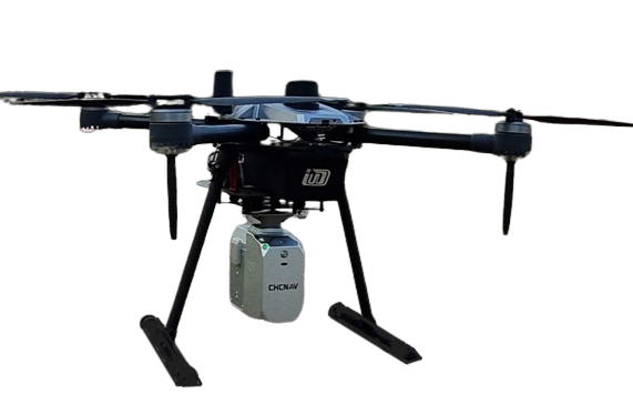
An unmanned aerial vehicle (UAV) is used in a drone survey to collect airborne data with downward-facing sensors like RGB or multispectral cameras and LiDAR payloads. The ground is photographed numerous times from various angles during a drone survey with an RGB camera, and each image is tagged with coordinates.
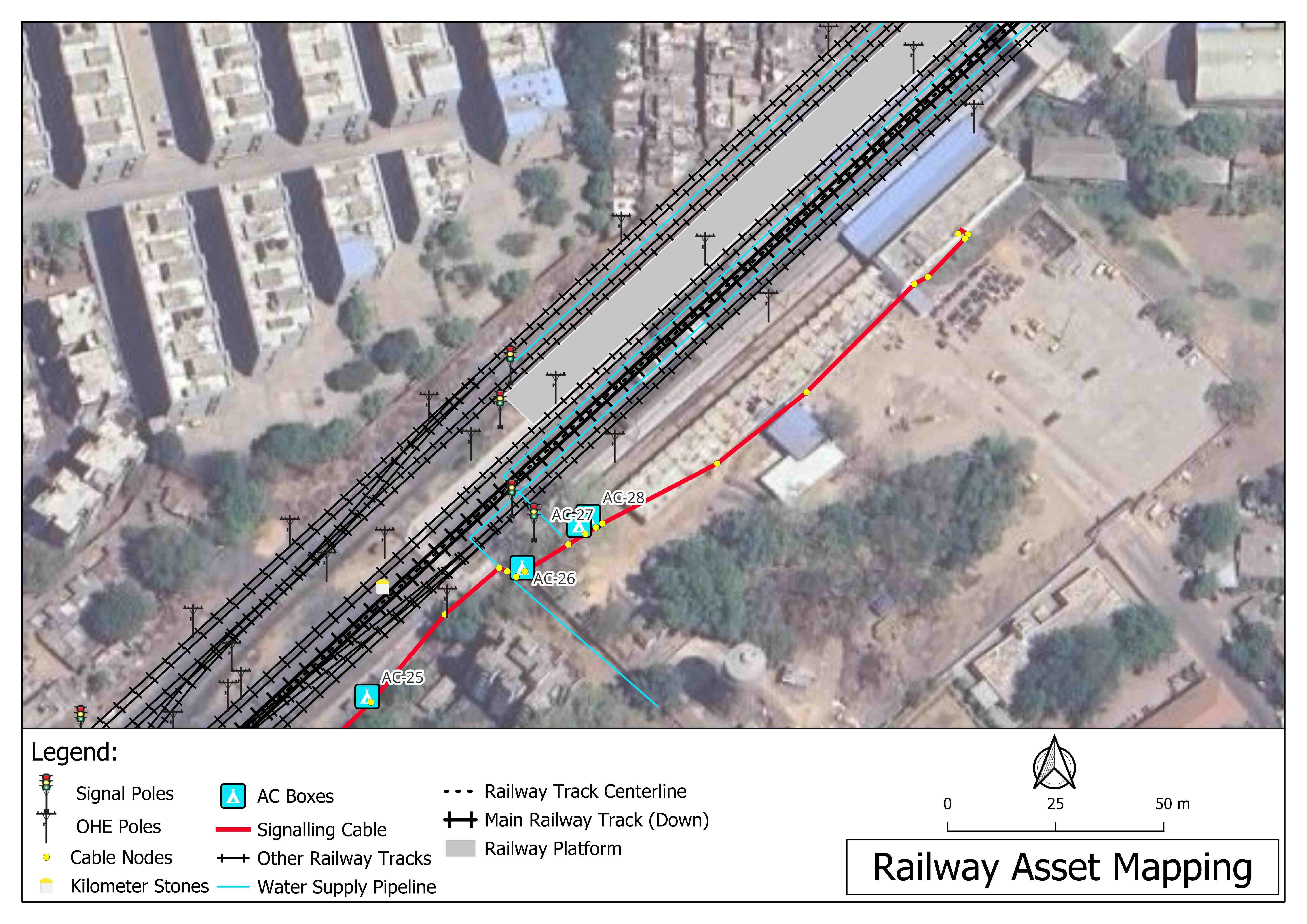
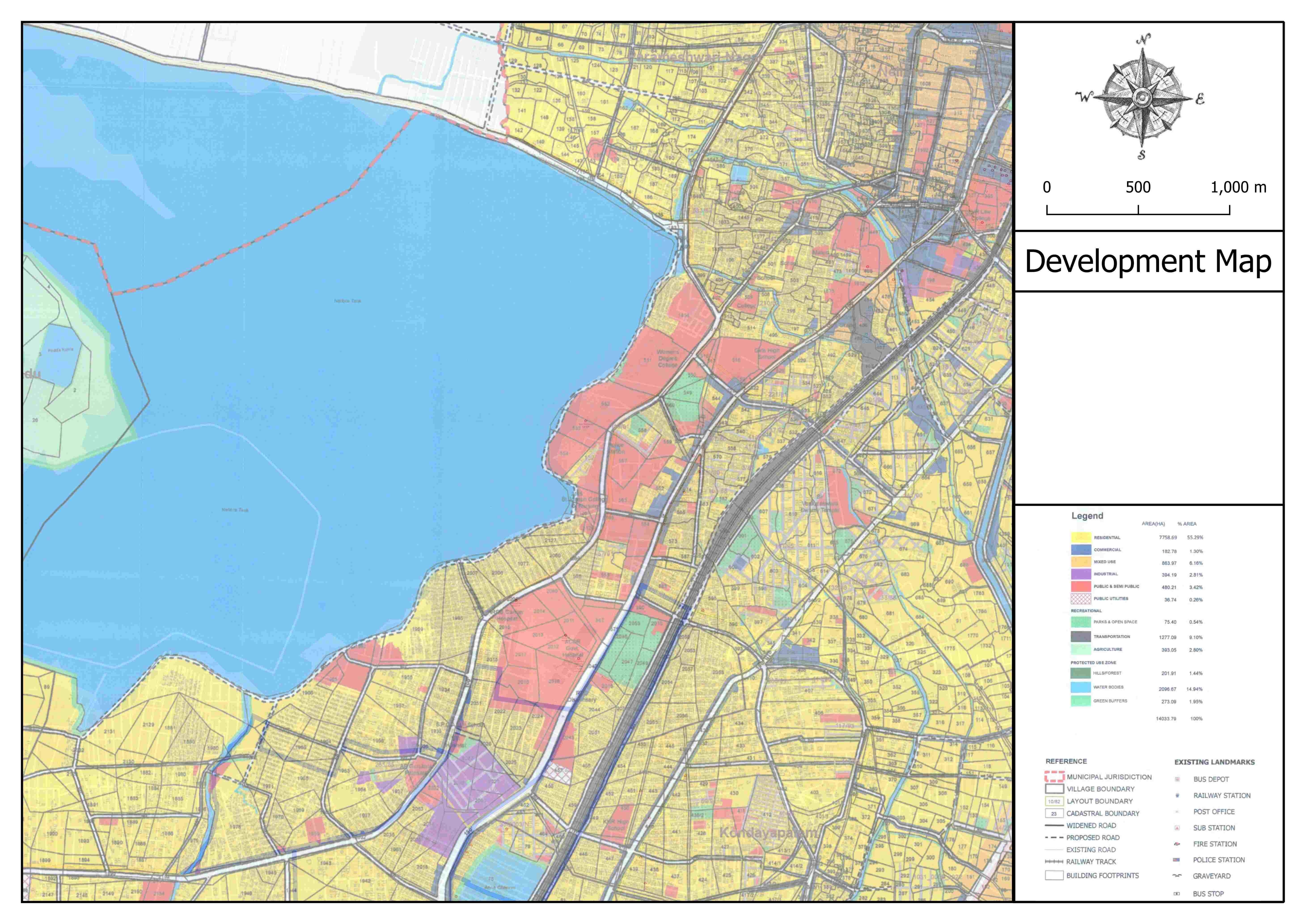
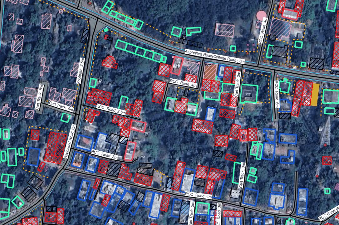
Our Geographic Information Systems (GIS) services offer comprehensive solutions for spatial data management and analysis. We specialize in GIS surveys, geo-referencing, and digitization of maps, ensuring accurate and up-to-date geographic information. Our asset mapping services help in identifying and managing physical assets efficiently. We create detailed development maps, base maps, and digital maps tailored to your needs. Additionally, we provide advanced GIS software and app solutions to streamline your workflows and enhance decision-making processes. Whether you need precise mapping, spatial data analysis, or custom GIS applications, our expertise ensures reliable and effective GIS solutions for your projects.

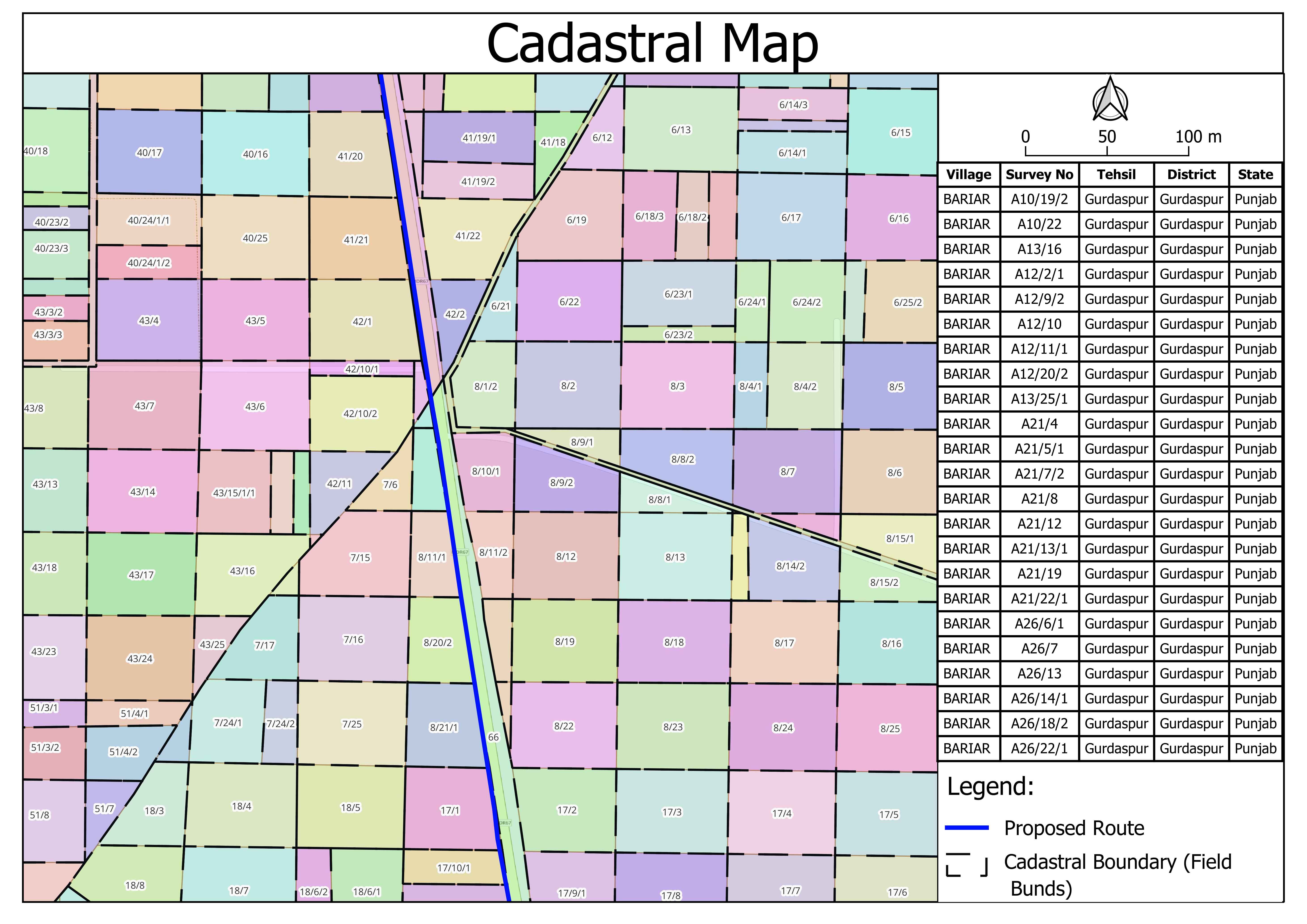
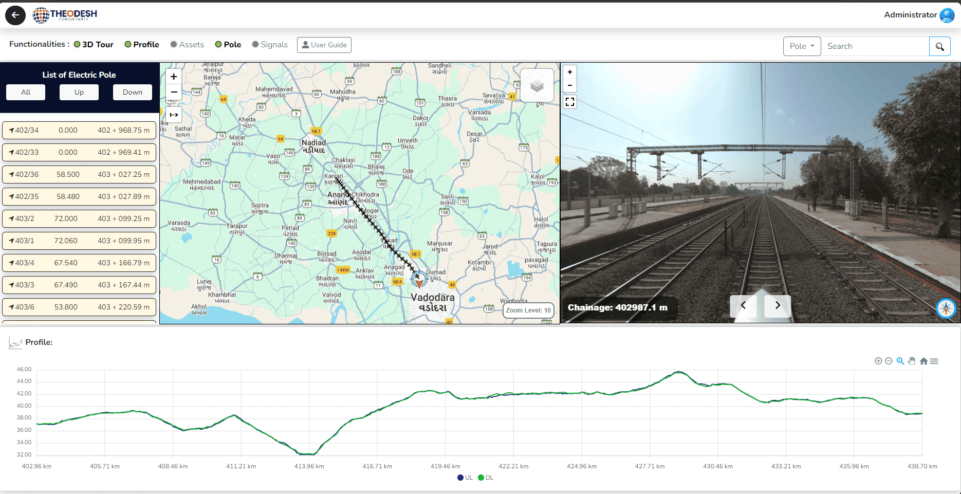
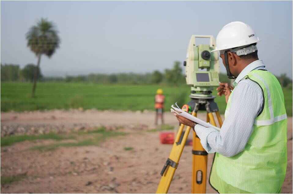
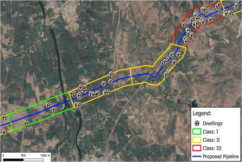
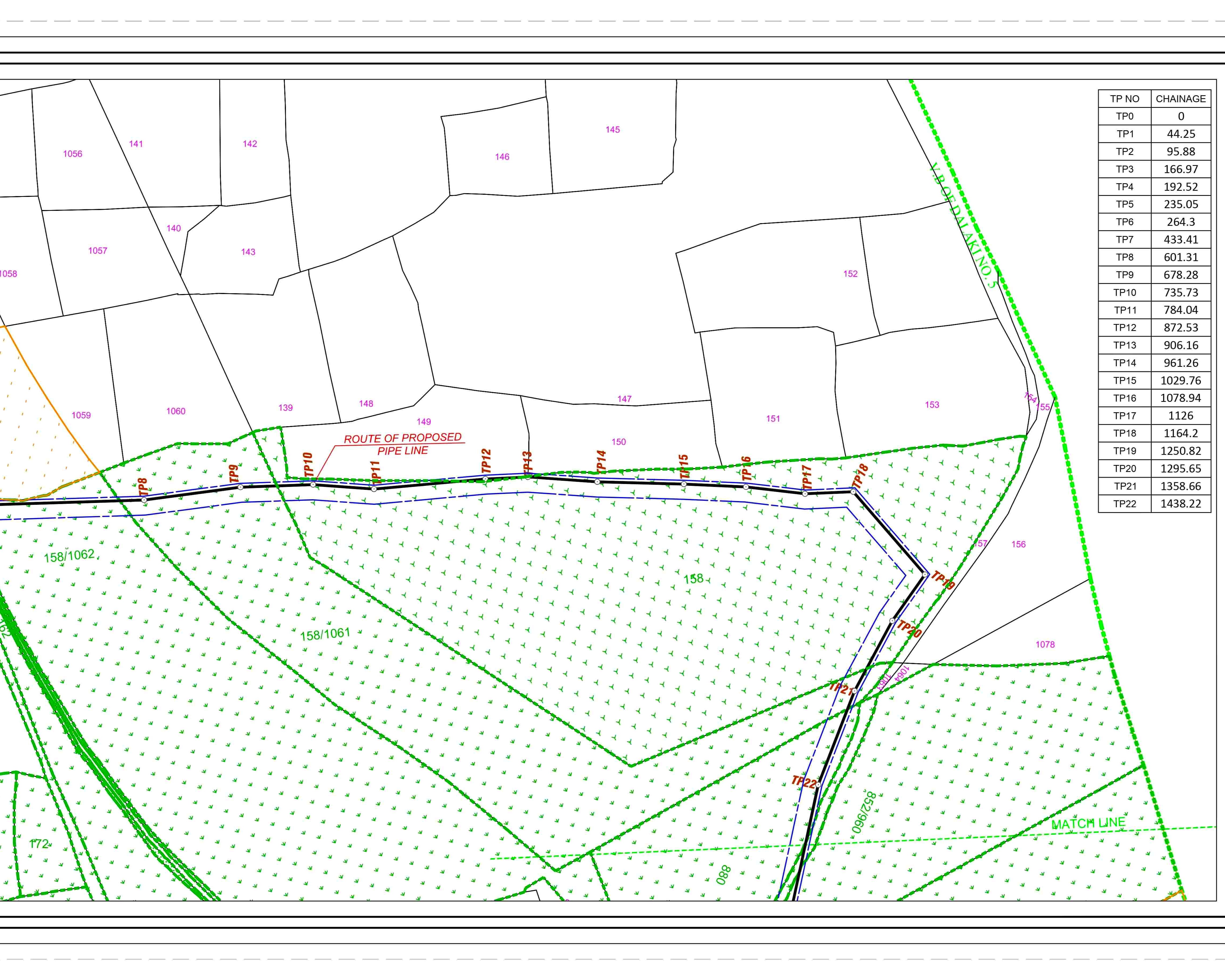
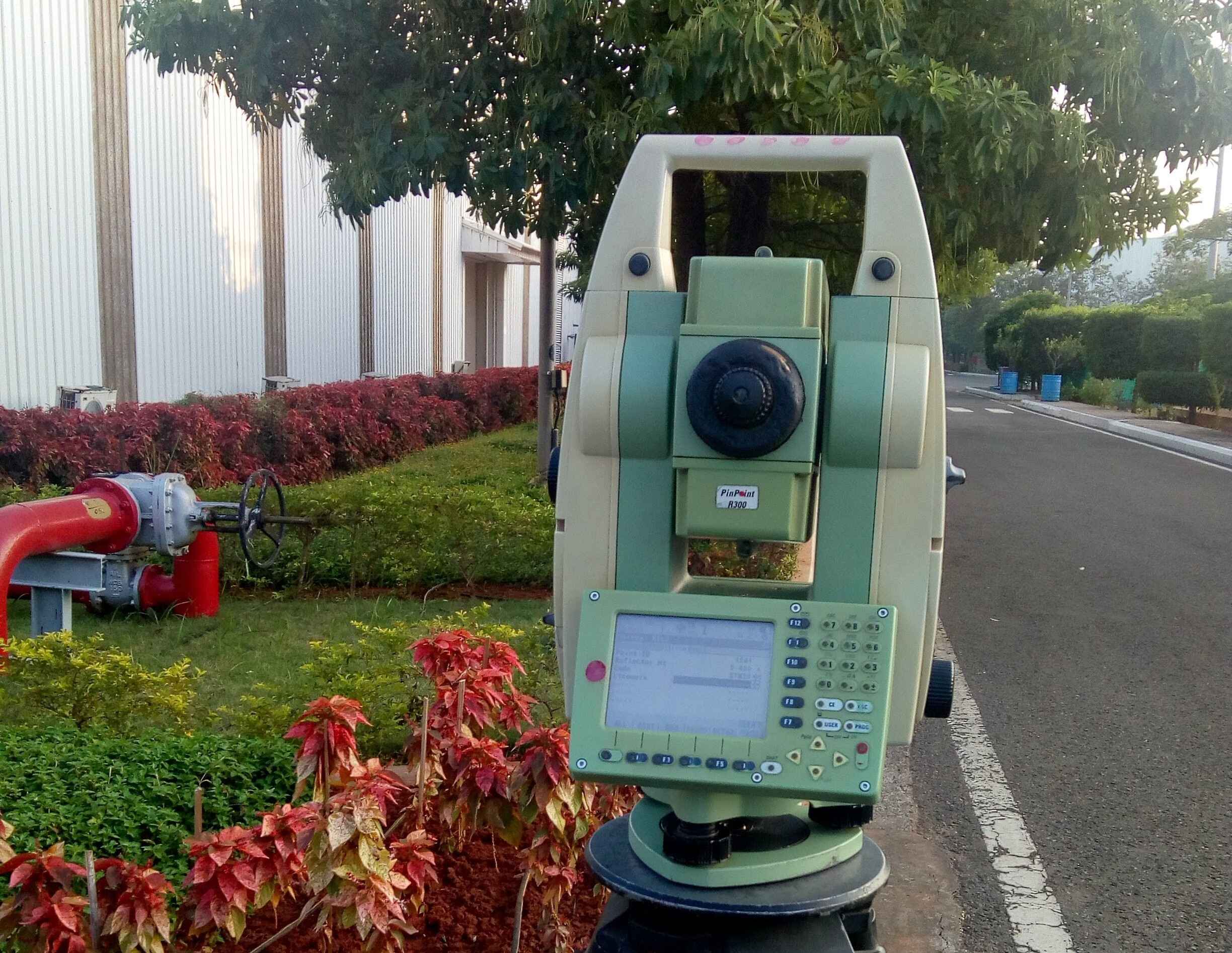
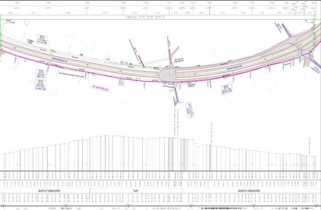
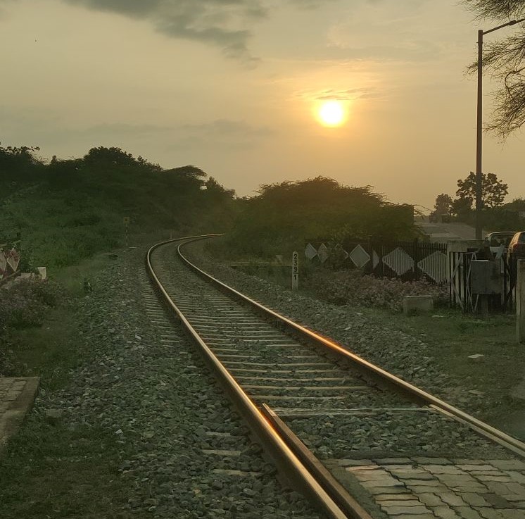
Our surveying services provide accurate and reliable solutions using advanced technology. We offer DGPS surveys for precise positioning, Cadastral surveys for exact land boundary mapping, and PDI surveys to integrate population data into pipeline projects. Our Pipeline/Alignment surveys create detailed plans for linear infrastructure, while City Surveys assess urban areas for potential development. We also offer As-Built surveys to document construction changes and Total Station surveys for precise measurements. Each service is designed to meet your needs with the highest standards of accuracy.
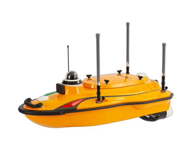
Utilize the CHCNAV Apache 3 Pro for precise and reliable hydrological surveys. Our advanced equipment ensures accurate data collection for a variety of water-related studies and projects, offering unparalleled insights and analysis.
Hydrological surveys involve the systematic measurement and analysis of water bodies, including rivers, lakes, reservoirs, and coastal areas. These surveys are essential for understanding water dynamics, assessing water quality, managing water resources, and mitigating flood risks. Key aspects of hydrological surveFys include
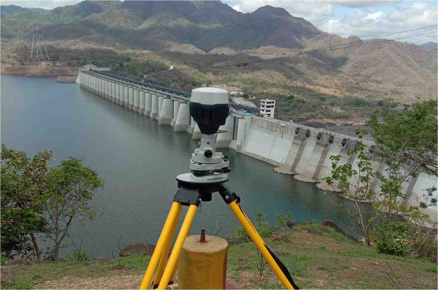
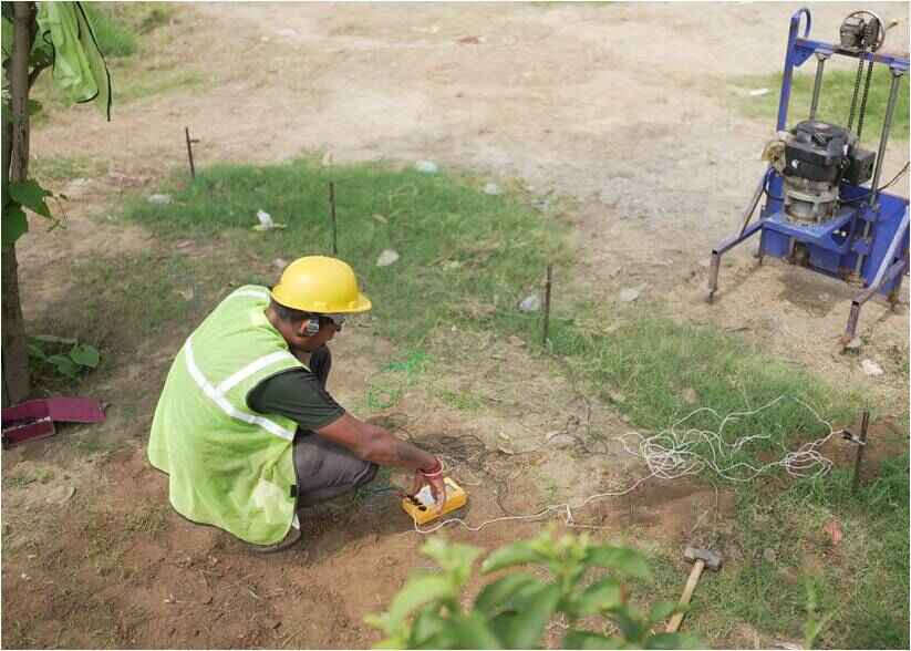
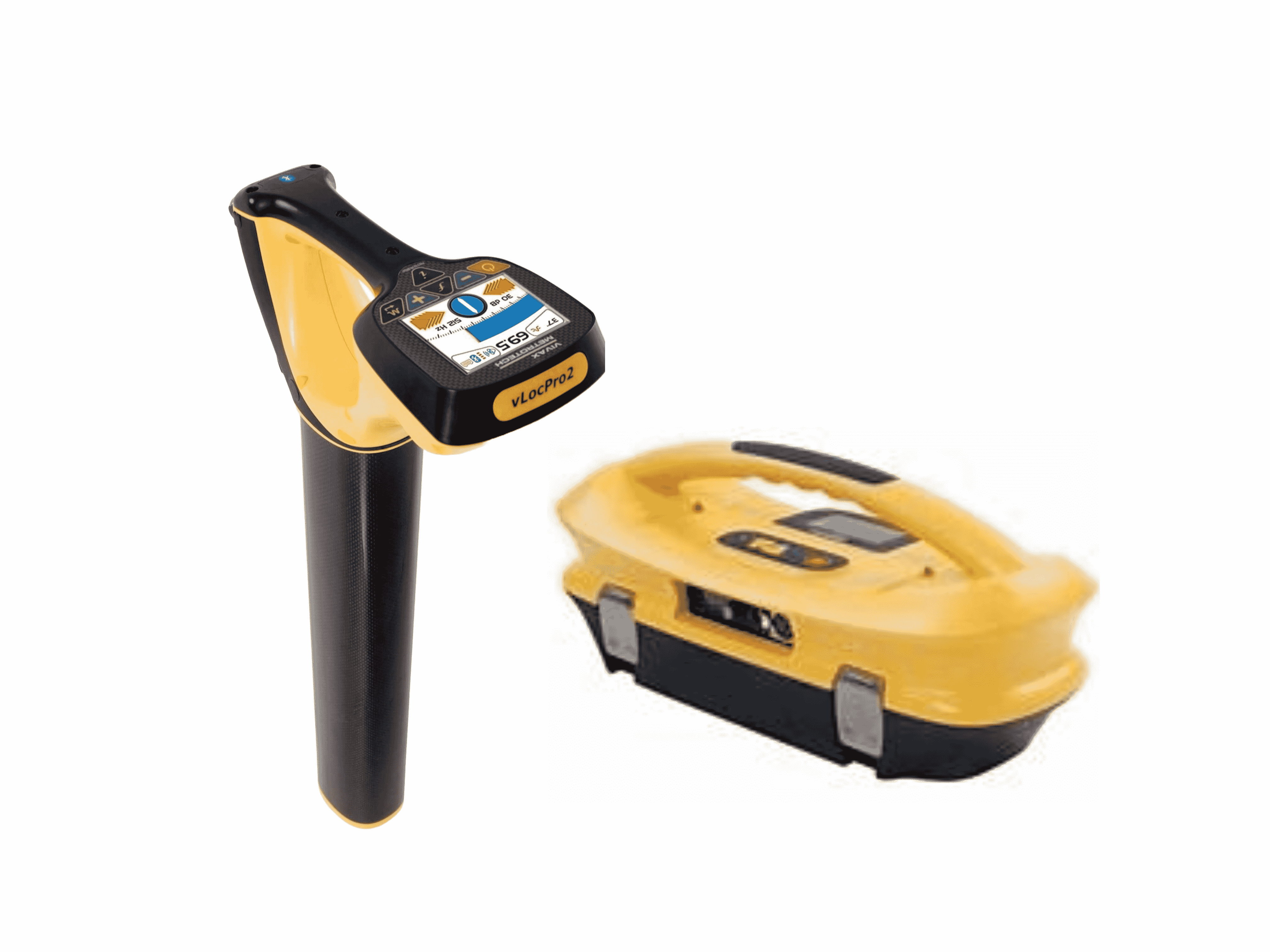
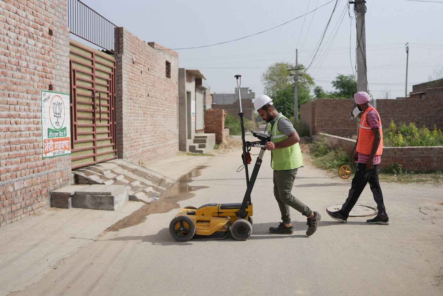
Our geophysical services provide vital insights into subsurface conditions through advanced surveying techniques. Utilizing cutting-edge technology and expert methodologies, we offer a range of specialized surveys designed to accurately assess and map underground features. These services are essential for ensuring the safety, efficiency, and longevity of various infrastructure projects.
Statutory clearance typically refers to the process of obtaining legal authorization or permission from a Government or regulatory body to carry out certain activities that are governed by specific laws or regulations. These activities may include construction projects, land development, transportation infrastructure, and other similar endeavors. It involves submitting applications, documentation, and other required information to the appropriate government or regulatory authorities for review and approval.
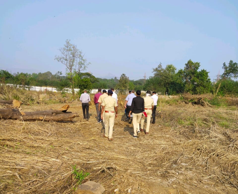
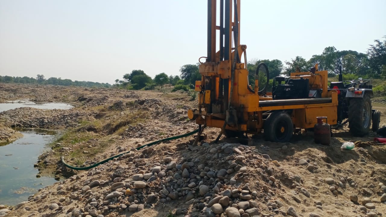
Geotechnical investigation is a method used to evaluate the engineering characteristics and behavior of soil and rock materials at a specific site. It normally incorporates a variety of field and laboratory testing techniques, the entire field work is overseen by Geotechnical Engineers.

We specialize in developing customized software solutions tailored to meet your specific needs
and
objectives by putting scientific and technological ideas to work based on your needs. We possess
proficiency in various coding languages, analytical and problem-solving abilities along with
understanding the phases of the software development life cycle.
Our software development team develops desktop applications. Our team's expertise in this area
also
extends to database and web development tasks.

Our Technical Team has a reputation for providing reliable service and successfully completing all projects so far.
Our continuous innovation and adoption of the latest technologies have resulted in the successful execution of multiple projects.
Delivering a technically sound solution is our topmost priority, leading to happy and repeat clients.

82-83,
3rd
Floor, SuryaKiran
Complex Opp. Banker's Heart Institute
Old Padra Road, Vadodara -
390015
Gujarat, India.
Mon - Sat : 09.30 AM - 06.00 PM
0265-2339492
theodesh@tdcl.in


