About Area Survey/ Potential Survey
A property survey is a detailed analysis and measurement of a plot of land or other piece of property to ascertain accurate and legally recognized information, such as boundaries, dimensions, topography, and existing structures. Based on the particular demands and requirements of the property and clients, several types of surveys, such as boundary surveys and topographic surveys, are carried out.
Our area of expertise is offering precise and trustworthy property surveying solutions. With our expertise and cutting-edge technology, we deliver thorough survey reports that enable you to make knowledgeable decisions about your property.
Purposes of an Area Survey / Potential Survey
- The main objective of an area survey is to create a precise map of a city or area.
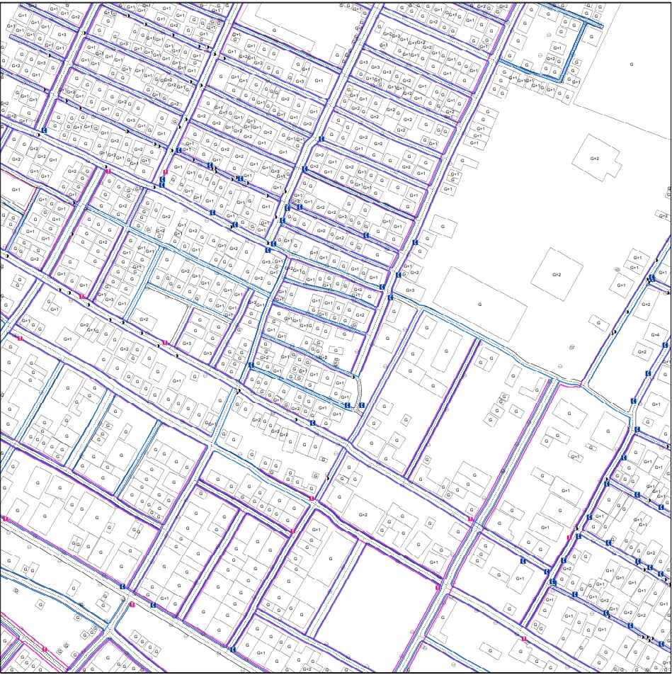
- Data collection during an area survey includes determining the precise dimensions, size, and location of buildings, roads, streets, highways, railways, bridges, tunnels, utilities like water, sewer, and electricity, public transportation, and landmarks.
- GIS (Geographic Information System) technology plays a crucial role in conducting area surveys by combining geographical and attribute data.
- Area surveys find applications in various industries, such as city utilities planning, disaster relief, transportation, agriculture, and urban planning.
Our Survey Process:-
- Consultation: To ensure that our services meet your demands, we first fully comprehend your survey requirements and project goals.
- Field Survey: Our knowledgeable surveyors conduct on-site measurements while utilizing cutting-edge equipment to get precise data.
- Data Analysis: At our office, we carefully analyze the information gathered, cross-referencing old records as necessary.
- Survey Report: Output shall be a thorough survey report and drawing that includes accurate visual representations of your property as well as legal descriptions.